

RE-DESIGNING TRANSIT MAPS FOR MACOMB, IL
AUGUST - DECEMBER 2022


The Idea
I didn’t have a car on campus. My parents dropped me off and that was it. I rode the train to and from home, and mostly walked everywhere else. It was great! But a major reason I chose Western was the buses. Free to everyone, no ID or pass required, that supposedly run all around campus and into town 7 days a week.
My first day on campus I vowed to find out how these buses worked.
By the 3rd semester I knew without a doubt this Is what I wanted to do. Day one of the semester I walked up to my teacher and said with conviction, I want to redesign the bus maps for my honors project.
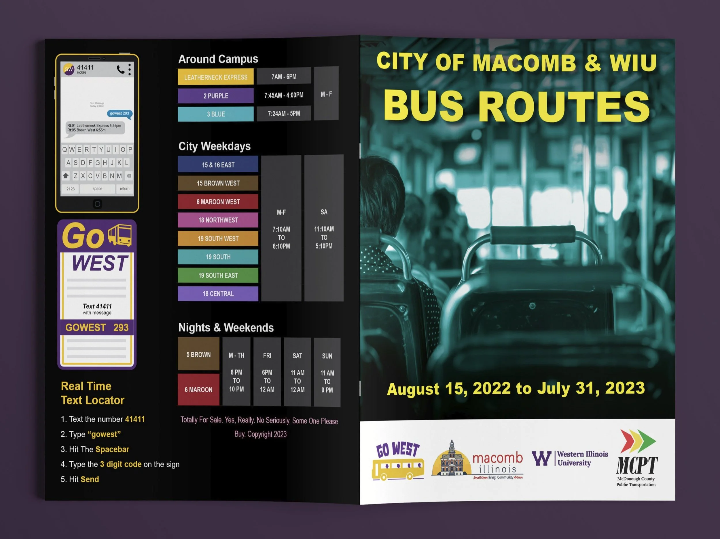
Creating The Maps
First I looked at the old maps and flipping through page by page wrote down everything I could think of. I went to the library and looked at different materials, brochures and magazines for inspiration. I also went online and looked at examples from the London Underground and the Chicago CTA, two of the most famous public transit systems in the world.
Finally I jumped into the creation. I started with the easy parts first, recreating the list of rules and the yearly schedule was easy and straightforward. It took just a few days to create a calendar that looked clean and usable, as well as a front cover I quickly threw together in Photoshop.
The hardest hurdle to overcome was the maps. It took about 6 weeks of research, trial and error and a lot of mistakes. But in the end, all of the maps were created in illustrator and the tables were all made in InDesign to create 16 pages for the complete set of maps.